
S-100: the new data standard for electronic navigation
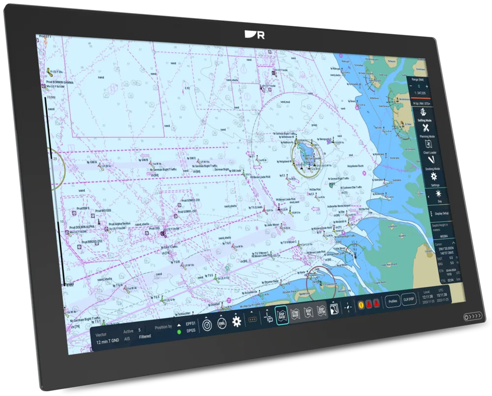
The chart is a small, illustrative S-100 ECDIS demo. Zoom with the mouse wheel (two fingers on a phone) out to the whole of Türkiye, and switch each layer and its animation on and off.
Moving to S-100: dates and data layers
S-100 is the International Hydrographic Organization's (IHO) new data framework for electronic charts and the data that sits on top of them. S-100 ECDIS may be used voluntarily from 1 January 2026 and becomes mandatory for ECDIS installed from 1 January 2029. An S-100 ECDIS can show high-resolution depths, predicted water levels and surface currents together with the chart. You do not have to replace a working ECDIS in 2029. The rule applies to equipment installed from that date.
S-100 ECDIS may be installed alongside S-57 systems on a voluntary basis (IMO MSC.530(106)).
Türkiye's Office of Navigation, Hydrography and Oceanography (SHODB) planned to start S-101 production for large-scale harbour charts, with the other S-100 products by 2029.
ADMIRALTY expects the first type-approved S-100 ECDIS from manufacturers.
ECDIS installed from this date, including retrofits, must meet the S-100 performance standard. Existing units are not forced to change and there is no planned end date for S-57 ENCs.
The main S-100 products
Electronic navigational chart
The next-generation ENC that will succeed S-57, with clearer symbols, better text placement and stronger security.
Bathymetric surface
A dense grid of seabed depths instead of fixed contours, so the safety contour can follow your ship's draught.
Water level information
Predicted and forecast water levels that change over time, replacing static tide predictions.
Surface currents
Current speed and direction on a high-resolution grid, for drift forecasts and route planning.
Navigational warnings
Navigational warnings delivered as data, so they can appear directly on the chart.
Under keel clearance management
Carries the planned safe depth margins for a transit into the ECDIS.
Route plan
A standard format for exchanging voyage plans between ship and shore, built on the S-100 framework.
Phase 1 product specification editions
The editions published in 2025 that the first S-100 ECDIS are built around.
| Product | Subject | Edition |
|---|---|---|
| S-101 | Electronic navigational chart | 2.0.0 |
| S-102 | Bathymetric surface | 3.0.0 |
| S-104 | Water level information | 2.0.0 |
| S-111 | Surface currents | 2.0.0 |
| S-124 | Navigational warnings | 2.0.0 |
| S-129 | Under keel clearance management | 2.0.0 |
| S-98 | How the products work together in S-100 navigation systems | 2.0.0 |
Do I have to replace my ECDIS because of S-100?
No. From 1 January 2029 the S-100 standard applies to ECDIS installed from that date, including retrofits. Existing approved units can stay in service, and S-57 ENCs have no planned end date. If you are fitting a new ECDIS now, it is worth choosing one that is S-100 ready.
Sources: IMO resolution MSC.530(106); IHO S-100 roadmap (Oct 2025); ADMIRALTY "S-100: your questions answered" (Sep 2026); Türkiye national report to MBSHC-24 (2024).
Planning for S-100?
We can tell you what an S-100 ready ECDIS means for your fleet and when it makes sense to change.